


In early September 2019, I visited southern Iceland for a week. As part of my research into Viking Age history, the legends and mythology, landscape has been important in shaping Icelandic legends. I was fortunate enough to see some of archaeological and cultural history of National Museum of Iceland in Reykjavik, ride Icelandic horses, visit several iconic waterfalls and tour the some of the unique Icelandic landscape.

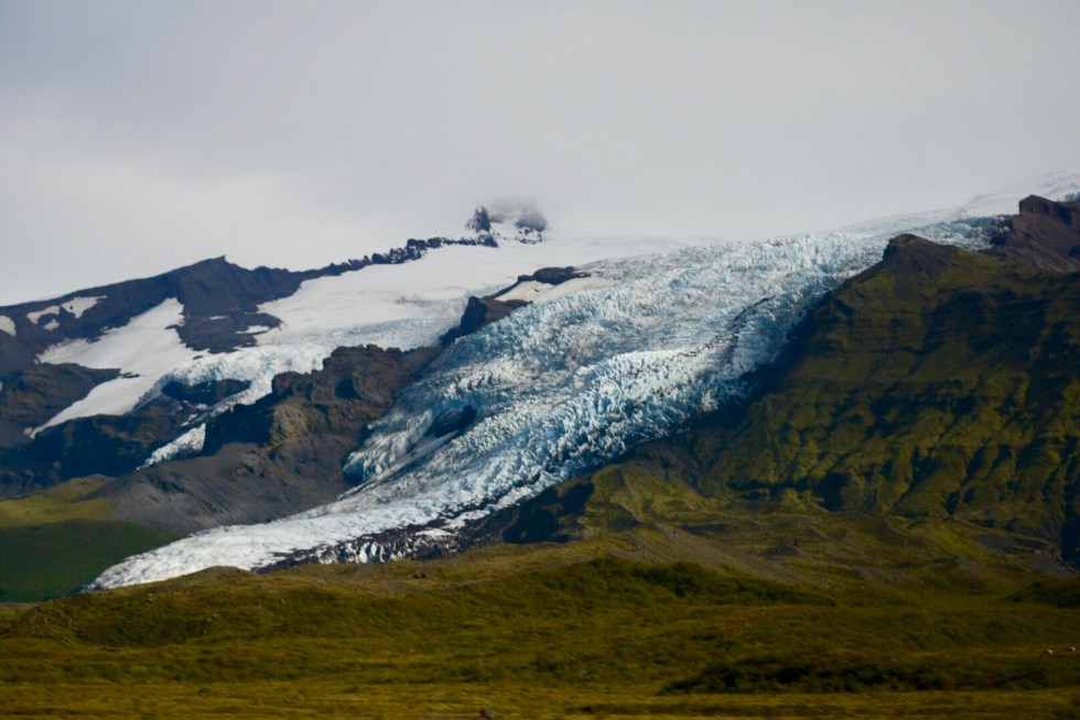
Southern Iceland boasts stunning waterfalls, glaciers and volcanoes. The largest glacier in Europe, Vatnajökull is located within Vatnajökull National Park which contains the largest and most active volcanoes in Iceland. On the southern side of Vatnajökull, the glacier completely covers the volcano beneath. Known as Öræfajökull, the glacier enveloping the volcano is also the highest peak in Iceland with the mountain peak, Hvannadalshnúkur reaching 2, 000 m above sea level. Although peaks in Iceland are not high but European standards, the entirety of the huge glacier Vatnajökull, envelops several active volcanoes. The size of Vatnajökull is impressive with the Ring Road skirting the edge of the glacier along the coastline from just east of Vik and continuing past Hof which was the furthest extent of our tour.


Myrdalsjokull, is the fourth largest glacier in Iceland and located further west toward Reykjavik than Vatnajökull but the outlet glacier, Sólheimajökull is popular for glacier walks and all-year tours with frequent monitoring of the nearby active Katla volcano located beneath the distant ice cap of Myrdalsjokull. The outlet glacier Sólheimajökull is easily accessible via sign-posted valley entrances off the main the Ring Road along the southern coastline with a 20 minute hike to a glacial lagoon.

The 20 minute hike to the Sólheimajökull glacier includes traversing the edge of the lagoon formed by glacial melt. Each year the size of the lagoon increases with warmer global weather influencing the temperature and extent of thawing and glacial melt each year. In Iceland, the constant volcanic activity means that the glaciers are often streaked or covered in volcanic ash and these are known as “dirty glaciers” due to their black streaked appearance from frequent volcanic eruptions. The lagoon is also formed from volcanic sand and large pinnacles of volcanic ash are common on the glacier surface.


The final view looking back to Myrdalsjokull as the weather closed around the glacier and lagoon, rain and light snow obscuring much of the way back we had come.
A short video on Solheimjoskull glacier showIng some of the surrounding landscape filmed despite the incredible strength of the erratic wind across the glacier threatening to knock me down if not for the crampons holding fast in the ice.
Loved the photos and video. Thanks for sharing.
[…] landscape. On a tour of the unique southern Icelandic landscape, I visited iconic waterfalls, glaciers, black sand beaches, glacial lagoons and rode Icelandic […]
[…] landscape. On a tour of the unique southern Icelandic landscape, I visited iconic waterfalls, glaciers, black sand beaches, glacial lagoons and rode Icelandic […]
Thank you! Iceland was stunning, I’d love to explore the country with more time
Really nice post with stunning photos!
Iceland is a great location for exploration. Thanks for sharing